Marin’s natural beauty can be attributed in part to its wooded slopes and valleys. Given the recent increase in California wildfires, clients often ask us about wildfire hazards in Marin. Although insurance companies have become cautious about insuring homes in the county because of the large fires further north in the state, wildfires have not often occurred in Marin. Most fires were in undeveloped areas.
Marin’s Wildfire History
Marin largest wildfire, in 1923, began in Ignacio in southern Novato and burned about 40,000 acres through Lucas Valley to Bolinas. Thirty homes were destroyed in Woodacre. The unusually strong winds, dry conditions, and high temperatures caused other wildfires in Northern California.
- In October 1995, the second largest wildfire, called the Mount Vision Fire, burned over 12,000 acres in the Point Reyes National Seashore. The fire, started by an incompletely extinguished campfire, destroyed 45 homes in Inverness Park, a small community near Point Reyes Station.
- The third largest wildfire, in 1936, burned 4,000 acres on Bolinas ridge in west Marin.
- In October 1917, the fourth largest fire occurred on the ridge west of Inverness in West Marin, burning 2,000 acres.
- The fifth largest and most disastrous in immediate financial loss was the 1929 Mill Valley fire, which burned for three days. Estimates of burned acreage range from 1,000 to 2,500 acres and destroyed from 110 to 117 homes.
The Marin Wildlife Prevention Authority
A wide majority of Marin voters passed Measure C in March 2020 to fund the Marin Wildlife Prevention Authority (MWPA), a multi-jurisdictional agency focused on proactive, state-of-the-art wildfire prevention and preparedness in Marin County. The MWPA is deeply involved in protecting homes throughout the county. Its efforts include:
Vegetation Management and Local Wildfire Prevention.
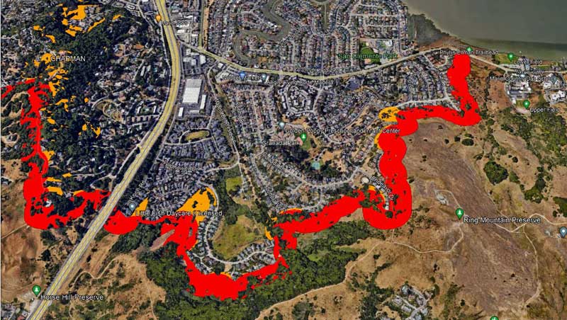
The MWPA is involved in a large number of vegetation management projects across the county, including, for example, the Greater Ross Valley Shaded Fuel Break Project. This project aims to protect homes from Fairfax to Corte Madera by reducing wildfire fuel on about 1,300 acres. Crews are removing flammable plants adjacent to homes in a 200-300 foot-wide path covering 38 miles, including invasive non-native plants like French broom, small diameter trees, dead and downed trees and branches, and dry, non-native grasses.

Map of the east end of the Greater Ross Valley Shaded Fuel Break Project, with the improved areas shown in red and yellow
This is only a small part of the remedial work. There are more projects, like thinning 145-acres and 16,870 highly flammable eucalyptus trees in San Rafael and San Anselmo. On January 23, 2024, Marin County supervisors approved environmental analysis of the project that was required under the California Environmental Quality Act.
Detection, Alert and Evacuation
MWPA is working to implement these safety measures during a wildfire event:
- State-of-the-art wildfire detection, warning, and alert systems
- A county-wide network of safe evacuation routes
- Temporary refuge areas for residents during evacuations to reduce loss of life and property.
Defensible Space and Home Hardening Evaluations
MWPA and contributing cities offer free assessments of a home’s defensible space (the buffer between a structure and the vegetation that surrounds it) and home hardening measures to address the most vulnerable components of a structure with building materials and installation techniques that increase resistance to heat, flames, and embers.
Grant Programs
The MWPA helps residents remediate issues found during home hardening inspections, including hardening of structures, the creation of defensible space, and fire-adapted landscaping.


